(Above) Townhomes along Elm Street in Gold Coast neighborhood of Chicago. Photo by Steven Dahlman. (Click on images to view larger versions.)
December 9, 2018 – The official map of City of Chicago communities resembles a colorful, ethnic patchwork quilt. Each patch defines neighborhood boundaries and represents a proud urban enclave filled with mostly hardworking, family-oriented people.

|
The City of Big Shoulders runs from Rogers Park, a beach and lakefront neighborhood on the Far North Side, to the East Side and the former sooty steel mill enclave on the Far South Side. From Far Southwest Side Mount Greenwood, surrounded by its seven cemeteries, to Far Northwest Side Edison Park, where hundreds of Chicago police and firefighters reside. |
In the 1970s, when famed columnist Mike Royko authored his award-winning book, Boss, about Mayor Richard J. Daley, he noted that historically, Chicago was a city of ethnic neighborhoods – Germany was on the North Side, Italy was on the West Side, and Ireland was on the Southwest Side. Today, all of that has changed.
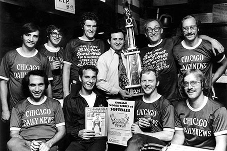
This writer is proud to say he has visited virtually all 77 Chicago neighborhoods and written stories about most of them over the past five decades. That included writing a 37-part series on Windy City neighborhoods while working as a reporter for Chicago Daily News in the 1970s.
Later, in the 1980s and early 1990s, as real estate editor of Chicago Sun-Times, for several years this writer co-authored the Chicago House Hunt Book, an annual publication which compiled facts, figures, and information on many Chicago neighborhoods.
|
Born in East Lakeview in 1944, I grew up and resided in Lincoln Park and Old Town. After college I rented an apartment in Roscoe Village and later lived in a historic row home on the landmark 1500 block of West Jackson Boulevard on the Near West Side. My first home, a large stucco built in 1911, was purchased in 1973 in the Irving Park “Villa” enclave. Eventually, I joined a team of owners to landmark the neighborhood in the late 1970s. When I told Royko I bought a home in “The Villa,” he said, “Congratulations, you now live in Polish Kenilworth.” (Right) Row houses in West Jackson Boulevard Historic District. |

|
My second home, a 1920s English Tudor, was acquired in 1985 in the upscale Sauganash enclave on the Northwest Side, where the late Mayor Jane Byrne once lived, and many streets are named after Pottawatomi Indians.
In 1998, I was fortunate to purchase the landmark 1872 Frederick Wacker House in Old Town, which features 14-foot ceilings and some of the most beautiful Victorian fretwork and woodwork in Chicago. Since 2005, I have resided in a spacious newer home along the North Branch of the Chicago River in North Park/Hollywood Park.

|
(Left) 1963 photo of residence built in 1872-73 for Chicago brewer Frederick Wacker. Photo by Clarence Laughlin obtained from University of Illinois at Urbana-Champaign. |
Old Navy ‘neighborhood’ t-shirt comes up 55 neighborhoods short
I know most of the city’s tree-lined side streets by name, every park where 16-inch Chicago-style softball is played, and virtually every rat-infested alley from one side of town to the other. That’s why when this veteran newsman read a recent newspaper story about the infamous Old Navy t-shirt on which the retailer printed a list of only 22 Chicago neighborhoods, I rolled my eyes.
Most of the swank North Side lakefront neighborhoods, such as Bucktown, Gold Coast, Lake View, Lincoln Park, Logan Square, Loop, Near North Side, North Center, Old Town, and Wicker Park are listed on the back of the shirt. The South Loop was included, along with Bridgeport, Bronzeville, Chinatown, and Pilsen.
Chicago Tribune freelance writer Zach Freeman correctly dubs the Old Navy t-shirt map as “the worst Chicago map ever” because it graphically lumps vast sections of the South Side, Far South Side, Southwest Side, and West Side, along with a large swath of the Northwest Side, into a vast wasteland of nondescript neighborhoods without specific identities.
For example, the “Northwest Nowhere” section of the map, named “O’Hare,” ignores dozens of fine neighborhoods, including Belmont-Cragin, Dunning, Edgebrook, Edison Park, Forest Glen, Jefferson Park, Old Norwood Park, Portage Park, Sauganash, The Villa, and Wildwood.
|
(Right) Old Navy Chicago Neighborhood Map Shirt. Image obtained from Teegogo. |
 |
The low-priced t-shirt graphic lists the huge area west of Western Avenue as the Far West Side but erases every neighborhood from Galewood and Austin to Humboldt Park and Garfield Park, from Little Village to North Lawndale and Lawndale.
The South Side shirt image forgets to include Back of the Yards, Brighton Park, Englewood, Gage Park, Gresham, Marquette Park, and West Englewood. Hyde Park, Kenwood, Oakland, and South Shore are lumped together and dubbed the South Chicago Shore.
The Far South Side t-shirt image ignores Avalon Park, Calumet Heights, East Side, Hegewisch, Pullman, South Chicago, South Deering, and West Pullman neighborhoods, which cover much of the 10th Ward.

|
(Left) West Pullman Elementary School and students from a brochure published in 1900 by West Pullman Land Association. |
During a tour in the 1970s, former 10th Ward Alderman Edward “Fast Eddie” Vrdolyak drove this writer into a cornfield on the extreme Southeast Side to show off his sprawling brick mansion. At that time, it was the last house built on the last street on the Far South East Side.
How could the retailer ignore the beautiful Far Southwest Side neighborhood of Beverly? The neighborhood’s Longwood Drive, a residential haven for Chicago politicians for decades, is one of the city’s most beautiful streets.
Other omissions were leafy Mount Greenwood, Ashburn, Washington Heights, and Morgan Park. That’s ironic, since Old Navy recently opened its sixth Chicago store in Morgan Park. The retailer also has stores in the Loop and South Loop and at least two in Lincoln Park.
Over the years, Realtors, developers, and community groups have created sub-neighborhoods and stretched the boundaries into new enclaves which have expanded Chicago’s neighborhood-and-community count to more than 230 distinct pockets and areas, according to appraisers.
After Old Navy was informed about the inaccuracies of the item, which apparently has been on the shelves for three years, the retailer pledged to develop a new design “in the near future.”